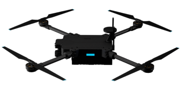
Advanced GCS Capabilities
Ensight is engineered for mission-critical reliability, providing the tools needed for complex aerial operations.
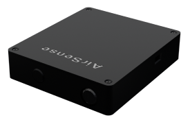
Secure Link
End-to-end asymmetric encryption ensures your mission data remains confidential and tamper-proof.
Real-time Sync
Instant synchronization between the GCS and UAV for zero-latency control and data visualization.
Adaptive UI
A workspace that evolves with your mission. Customizable layouts tailored for specific operational needs

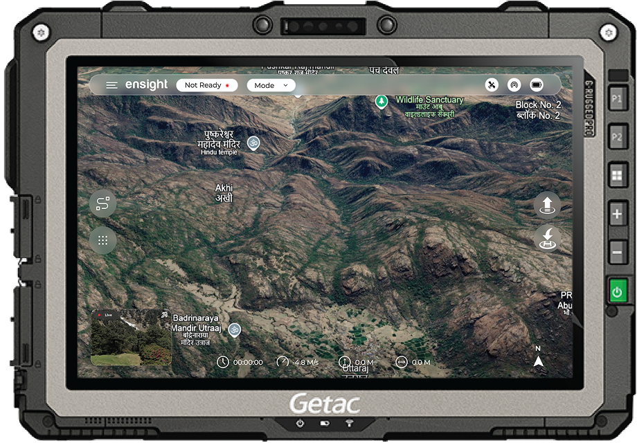
Interface
Intuitive Control
Experience a ground control station that feels like an extension of your intent. Ensight's interface minimizes cognitive load, allowing you to focus on the mission, not the software.
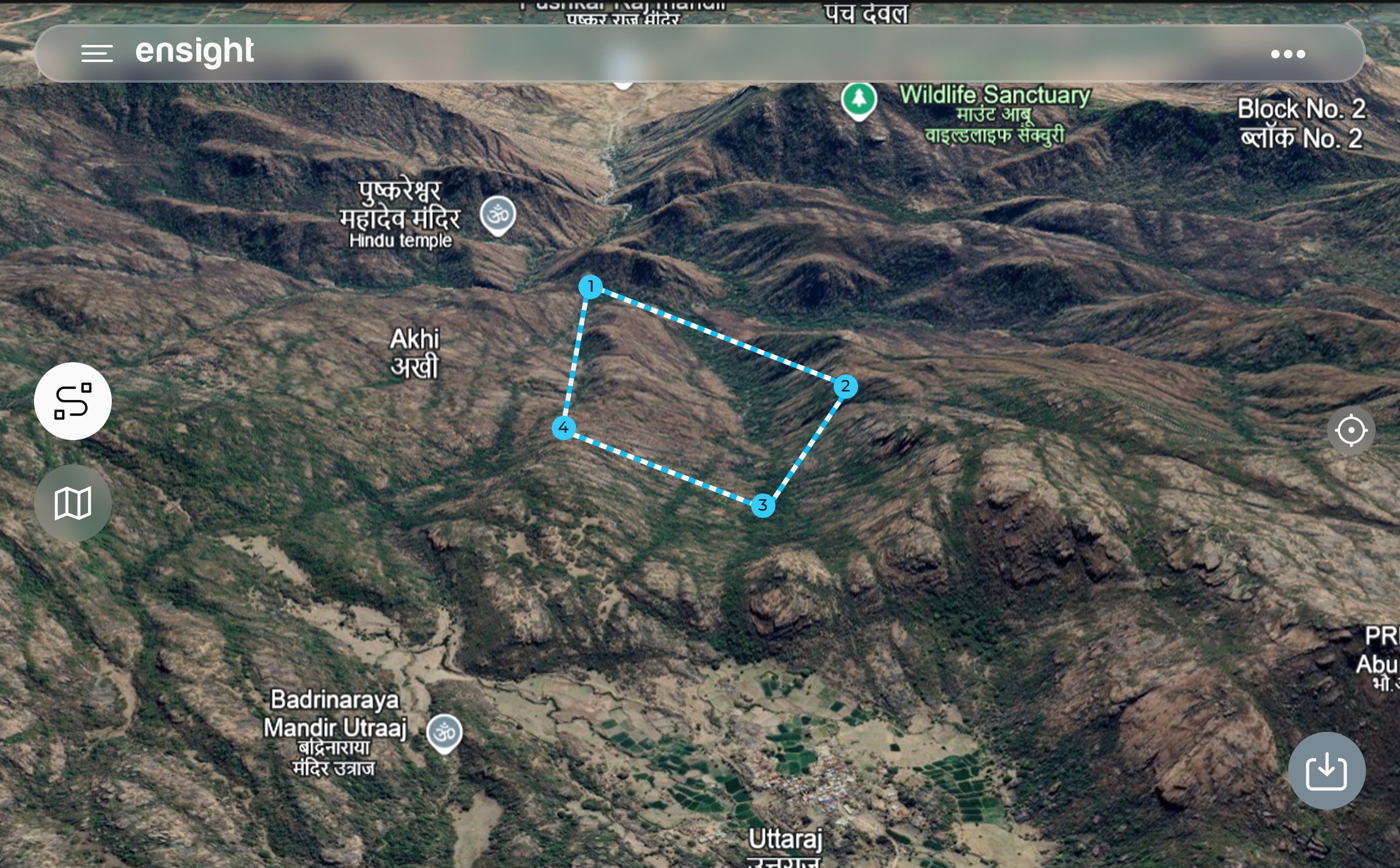
Planning
Precision Planning
From simple waypoints to complex 3D mapping missions, Ensight provides the tools for surgical precision. Automated route optimization saves time and battery life.
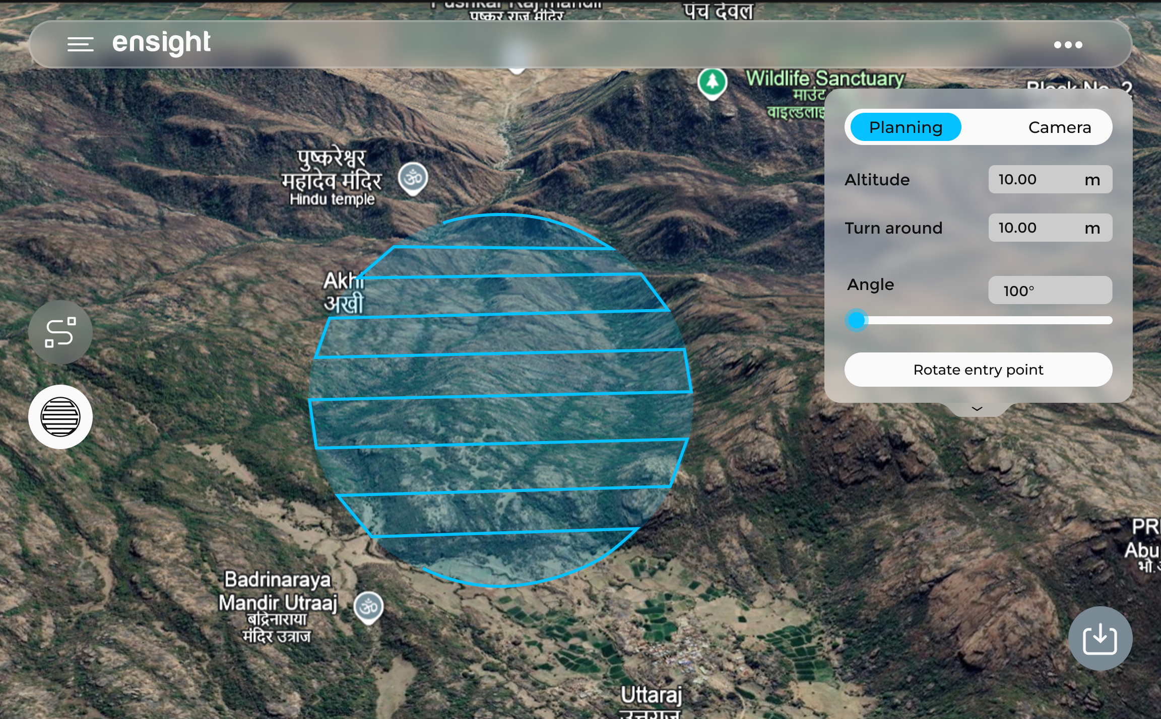
Survey Mode
Aerial Surveying
Survey Mode enables precise, repeatable data collection for mapping and analysis. Automated flight paths, controlled overlaps, and terrain-aware altitude adjustments ensure consistent results with maximum efficiency.
Intelligence
Real-time AI Insights
Harness the power of on-edge AI. Ensight visualizes detection data instantly, providing actionable intelligence for security, inspection, and search operations.
Object Tracking
Follow targets with precision.
Anomaly Detection
Identify risks automatically.
AI Detection Models
Ensight is the backbone for diverse industrial and tactical operations worldwide, providing precision and intelligence where it matters most.
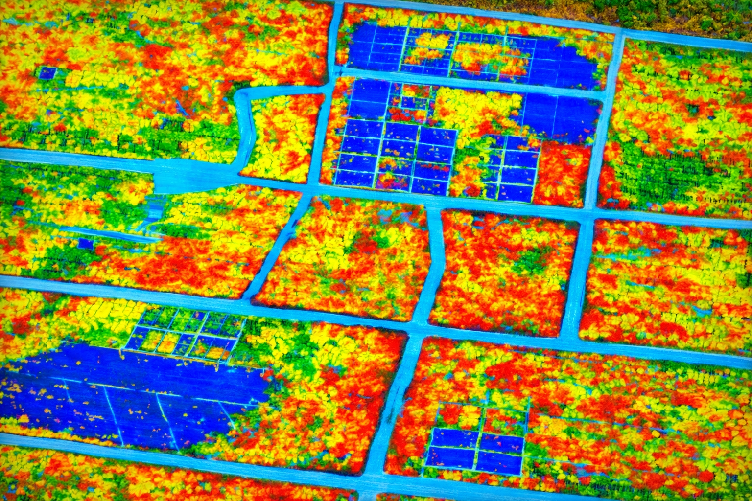
Tree Detection
Optimize crop yields and monitor forest health with high-resolution multispectral mapping and automated AI analysis.
- Automated Tree Counting
- Tree Health Indexing
- Forest Health Monitoring
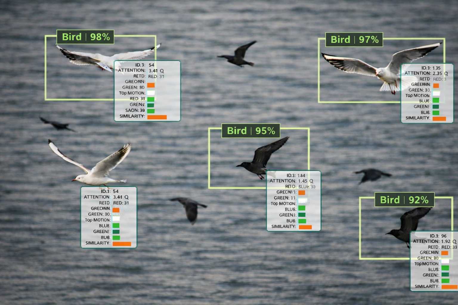
Bird Detection
Enhance situational awareness with secure, low-latency data links and real-time object tracking in complex environments.
- Animal Tracking
- Night Vision & Thermal Tracking
- Wildlife Monitoring

Crowd Detection
Secure perimeters and monitor borders with AI-driven anomaly detection and long-range aerial reconnaissance.
- Intrusion Detection
- Perimeter Patrol Automation
- Crowd Monitoring Analytics
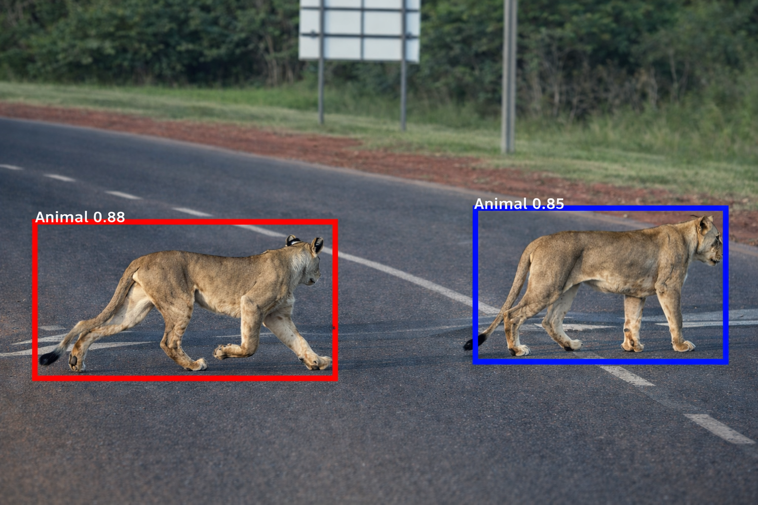
Animal Detection
Accelerate emergency response with live video feeds, thermal imaging, and rapid mapping of disaster-affected areas.
- Animal Tracking
- Wildlife Monitoring
- Wildlife Management