On edge environmental conservation
Optimize environmental conservation efforts through AI and aerial insights
Product used
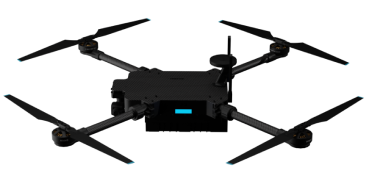
Inspector Lite

Inspector Lite: crafted for efficient, affordable, and dependable inspections. Inspector Lite is engineered to integrate AI on the edge, ensuring precise and intelligent analysis during inspections.
Its portability factor, combined with the capability to seamlessly integrate lightweight payloads, offers unparalleled flexibility. Designed for ease of use and rapid deployment, Inspector Lite features a foldable design for effortless transportation. Experience real-time insights, making inspections not just accurate but also swift and actionable.
Product Used
Industries
Drones in Environmental Conservation
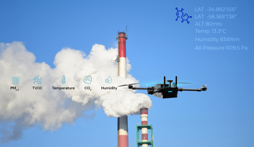
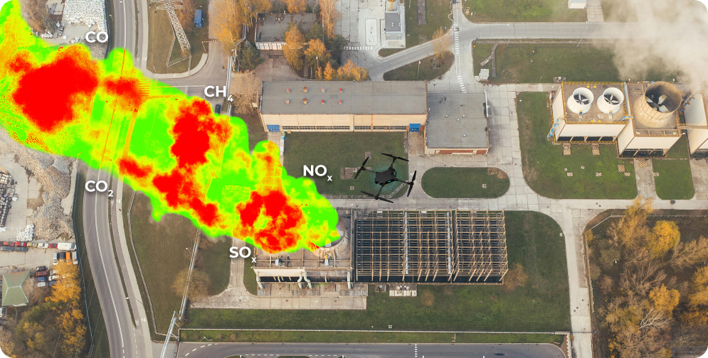
Air Quality Monitoring
Drones equipped with air quality sensors can provide mobile monitoring of air pollutants in areas where ground-based monitoring stations may not be feasible or accessible. These drones can fly at various altitudes and locations to capture real-time data on air quality parameters such as particulate matter (PM), nitrogen dioxide (NO2), ozone (O3), sulfur dioxide (SO2), and carbon monoxide (CO).

Tree Monitoring
AI-powered drones equipped with LiDAR sensors and high-resolution cameras can survey forests and tree cover. They capture data on tree density, species composition, and health status, allowing for forest health assessment and habitat monitoring. Analysis of drone-captured data helps in identifying deforestation, illegal logging, and invasive species encroachment, guiding conservation efforts.
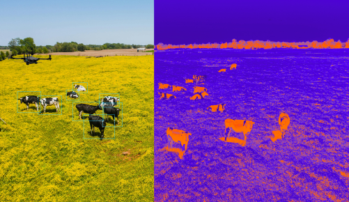
Animal Monitoring
Drones with thermal imaging cameras and onboard data processing can conduct aerial surveys of wildlife habitats. They track animal populations, behavior patterns, and migration routes without disturbing the animals. Analysis of drone-captured imagery helps in species population estimates, habitat suitability assessment, and identification of conservation priorities.
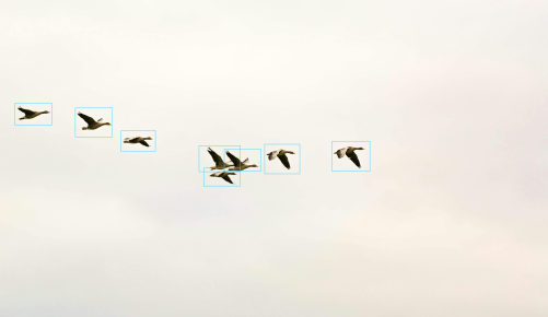
Bird Monitoring
AI-powered drones equipped with cameras and machine learning algorithms can survey bird populations and nesting sites. They provide valuable data on bird distribution, abundance, and habitat preferences. Analysis of drone-captured data helps in identifying threats to bird populations, such as habitat loss, pollution, and climate change.