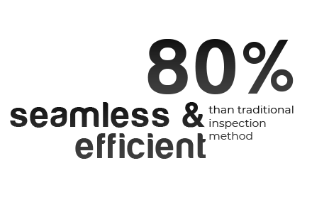
Transform geospatial inspection into a seamless and efficient process
Utilize Enord drones to streamline the geospatial inspection process, eliminating tedious and laborious tasks like field surveys and sample collections. This enables your human resources to focus on more valuable and engaging work.
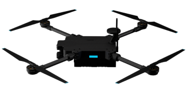
Enord provides a seamless and user-friendly solution. Our drones autonomously map inspection areas with minimal human input, generating comprehensive maps and capturing detailed, high-quality images for thorough geographical analysis.
Discover how AI can revolutionize
geospatial inspection.
Navigate autonomously with minimal human intervention
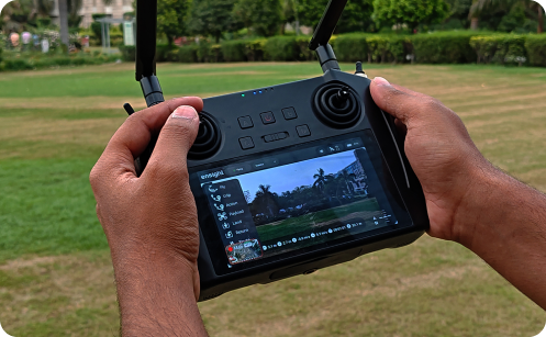
Operating Enord drones requires minimal operator intervention; it's effortless. Simply designate the area for inspection, and the drone will autonomously navigate within, capturing detailed images. These photos are then processed to create a comprehensive analysis report for your particular application.

Access faster and hassle-free analysis
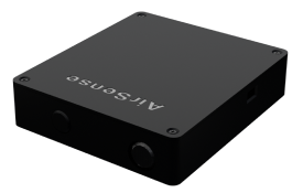
Get a comprehensive analysis report via our online data processing software, Ensight+. By uploading captured images, Ensight+ processes them to generate detailed orthomosaic maps, elevation models, and contour maps, ensuring faster and hassle-free outcomes.
Three more reasons
Enord makes Geospatial Inspection easy

AI Powered Navigation
Enord drones fly indoors or outdoors beyond GPS range, utilizing navigational cameras and a reliable AI-driven visual navigation system

Tailored Ecosystem
Enord provides a holistic solution with a suite of applications and drones tailored to streamline operations and boost efficiency.

Reduced Human Error
Mitigate human error in inspections and operations using AI-powered drones, ensuring accurate analysis and reducing mistakes.